Stock
Photo
Video
Audio
Vector
Collections
Packages
Lightboxes
Prints and Products
Wall Art
Canvas Prints
Framed Prints
Prints and Posters
Metal Prints
Acrylic Prints
Phone Cases
iPhone Cases
Galaxy Cases
Home Decor
Pillows
Duvet Covers
Shower Curtain
Clothes
T-Shirts
Souvenirs
Greeting Cards
Bags
Tote Bags
Categories
Site info
About
Support
Privacy Policy
FAQ
Contact Us
Google map
Shopping Cart
Member Area
English
Your Shopping Cart is empty.
Total:
View cart
Checkout
Home
Catalog
Download sample
File Details
Published:
2019-10-17 17:09:00.196327
Category:
Industry
Type:
Photo
Model release:
No
Share
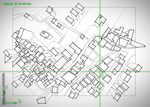
Imaginary city map of territory with 3D buildings of a residential district - concept image with a CAD (Computer-Aided Design) software interface
Contributor:
Francesco Scatena
ID : 296582180
Files
Prints and Products
Title
Filesize
Photo
4598x3278
Buy on Adobe Stock
Title
Price
Buy
Wall Art
Canvas Prints
30 USD or Credits
Framed Prints
10 USD or Credits
Prints and Posters
5 USD or Credits
Metal Prints
10 USD or Credits
Acrylic Prints
10 USD or Credits
Phone Cases
iPhone Cases
30 USD or Credits
Galaxy Cases
30 USD or Credits
Home Decor
Pillows
18 USD or Credits
Duvet Covers
100 USD or Credits
Shower Curtain
50 USD or Credits
Clothes
T-Shirts
20 USD or Credits
Souvenirs
Greeting Cards
3 USD or Credits
Bags
Tote Bags
20 USD or Credits
Order print
Keywords
map
,
cadastre
,
plan
,
planning
,
concept
,
concept
,
idea
,
land register
,
computer graphic
,
cad
,
graphic
,
survey
,
property
,
ownership
,
homeownership
,
field
,
dimensional
,
three-dimensional
,
residential area
,
copy space
,
cartography
,
topography
,
building
,
human hand
,
crayons
,
writing
,
drawing
,
valuation
,
building exterior
,
tax
,
taxation
,
measurement
,
measure
,
land
,
road
Related items
 software interface'))