Your Shopping Cart is empty.


Download sample
File Details
Published: 2020-10-07 15:59:41.299913 Category: Travel Type: Vector Model release: No
Share
       

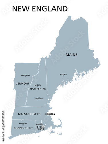
New England region of the United States of America, gray political map. The six states Maine, Vermont, New Hampshire, Massachusetts, Rhode Island and Connecticut with capitals. Illustration. Vector.

Contributor: Peter Hermes Furian
ID : 383533320

TitleFilesize
Vector6000x7973


Buy on Adobe Stock

Keywords
new england, map, new, england, state, state, region, region, united, political, maine, massachusetts, boston, connecticut, vermont, rhode, island, hampshire, new hampshire, rhode island, us, america, us, us, augusta, concord, providence, country, capital, border, america, administration, administrative, division, province, 6, mapping, atlas, cartography, geography, grey, white, isolated, background, illustration, vector