Your Shopping Cart is empty.


Download sample
File Details
Published: 2022-07-27 08:30:49.321567 Category: Buildings and Architecture Type: Vector Model release: No
Share
       

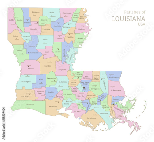
Political color map of Louisiana, USA federal state. Highly detailed map of Southern American region with territory borders and counties names labeled vector illustration

Contributor: Sunflower
ID : 519509404

TitleFilesize
Vector5000x4600


Buy on Adobe Stock

Keywords
map, louisiana, administrative, geography, political, colours, parish, vector, illustration, graphic, art, design, realistic, southern, division, county, name, province, voting, election, education, detailed, travel, cartography, us, symbol, signs, land, border, america, state, united, us, american, federal, shape, abstract, contour, city, topography, district, country, nation, earth, position, national