Your Shopping Cart is empty.


Download sample
File Details
Published: 2021-12-19 11:19:46.285372 Category: Graphic Resources Type: Vector Model release: No
Share
       

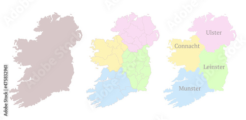
Provinces of Ireland map. Detailed outline and silhouette. Administrative divisions and counties. Set of vector maps. All isolated on white background. Template for design and infographics.

Contributor: Holthoff
ID : 475832961

TitleFilesize
Vector7150x3500


Buy on Adobe Stock

Keywords
ireland, map, province, vector, outline, contour, ulster, border, irish, administrative, set, isolated, division, region, municipality, district, county, blue, detailed, silhouette, political, travel, illustration, design, cartography, geography, europa, national, commonwealth, concept, icon, country, graphic, white, chart, shape, union, state, land, symbol, series, card