Stock
Photo
Video
Audio
Vector
Collections
Packages
Lightboxes
Prints and Products
Wall Art
Canvas Prints
Framed Prints
Prints and Posters
Metal Prints
Acrylic Prints
Phone Cases
iPhone Cases
Galaxy Cases
Home Decor
Pillows
Duvet Covers
Shower Curtain
Clothes
T-Shirts
Souvenirs
Greeting Cards
Bags
Tote Bags
Categories
Site info
About
Support
Privacy Policy
FAQ
Contact Us
Google map
Shopping Cart
Member Area
English
Your Shopping Cart is empty.
Total:
View cart
Checkout
Home
Catalog
Download sample
File Details
Published:
2025-11-17 08:02:57.514322
Category:
Travel
Type:
Photo
Model release:
No
Share
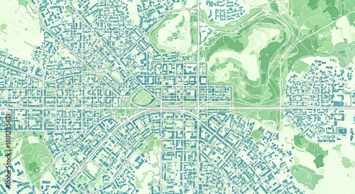
Top-down satellite-style map of a city featuring organized streets, neighborhoods, parks, and infrastructure in a grid pattern. 150 chars.
Contributor:
@TrendStudio
ID : 1801235621
Files
Prints and Products
Title
Filesize
Photo
6000x3273
Buy on Adobe Stock
Title
Price
Buy
Wall Art
Canvas Prints
30 USD or Credits
Framed Prints
10 USD or Credits
Prints and Posters
5 USD or Credits
Metal Prints
10 USD or Credits
Acrylic Prints
10 USD or Credits
Phone Cases
iPhone Cases
30 USD or Credits
Galaxy Cases
30 USD or Credits
Home Decor
Pillows
18 USD or Credits
Duvet Covers
100 USD or Credits
Shower Curtain
50 USD or Credits
Clothes
T-Shirts
20 USD or Credits
Souvenirs
Greeting Cards
3 USD or Credits
Bags
Tote Bags
20 USD or Credits
Order print
Keywords
aerial
,
view
,
urban
,
grid
,
layout
,
residential
,
green
,
area
,
road
,
network
,
map
,
city
,
street
,
neighbourhood
,
park
,
infrastructure
,
satellite
,
planning
,
block
,
district
,
development
,
land
,
use
,
topography
,
cartography
,
geography
,
spacial
,
design
,
suburb
,
avenue
,
boulevard
,
intersection
,
landmark
,
municipal
Related items
)